Review of the 19th International Scientific and Technical Conference "FROM IMAGERY TO DIGITAL REALITY: ERS & Photogrammetry"
 Determining the location of the annual Racurs’ conference is not an easy task. The choice of a country is based on a vision of market prospects, activity of partners, interests of users and our curiosity. The decision to move east, to the Republic of Korea, has come easily like never before.
Korea is a unique country in relation to Russia. Despite the geographically close location, culturally and technologically this state still remains mysterious.
Racurs has been successfully cooperating with key South Korean companies of the remote sensing market for the long time, being a partner of SI Imaging Services - the exclusive provider of KOMPSAT data. Our companies jointly export geospatial solutions based on Korean satellite imageries and Russian photogrammetric technologies PHOTOMOD.
Conference organizers, sponsor and scientific support
Conference organizers:
· Racurs (Russia)
· SI Imaging Services (Republic of Korea)
Conference sponsors:
· Platinum Sponsor: ROSCOSMOS (Russia)
· Gold Sponsor: Roscartography (Russia)
· Silver Sponsors: Airbus D&S (France), MAXAR Technologies (USA), SI Imaging Services (Republic of Korea)
Scientific committee:
· ISPRS - International Society for Photogrammetry and Remote Sensing
· ROSCOSMOS
· The Federal Service for State Registration, Cadastre and Cartography (Rosreestr)
· The Russian Society of Geodesy, Cartography and Land Management (ROSGEOKART)
· GLONASS/GNSS Forum Association
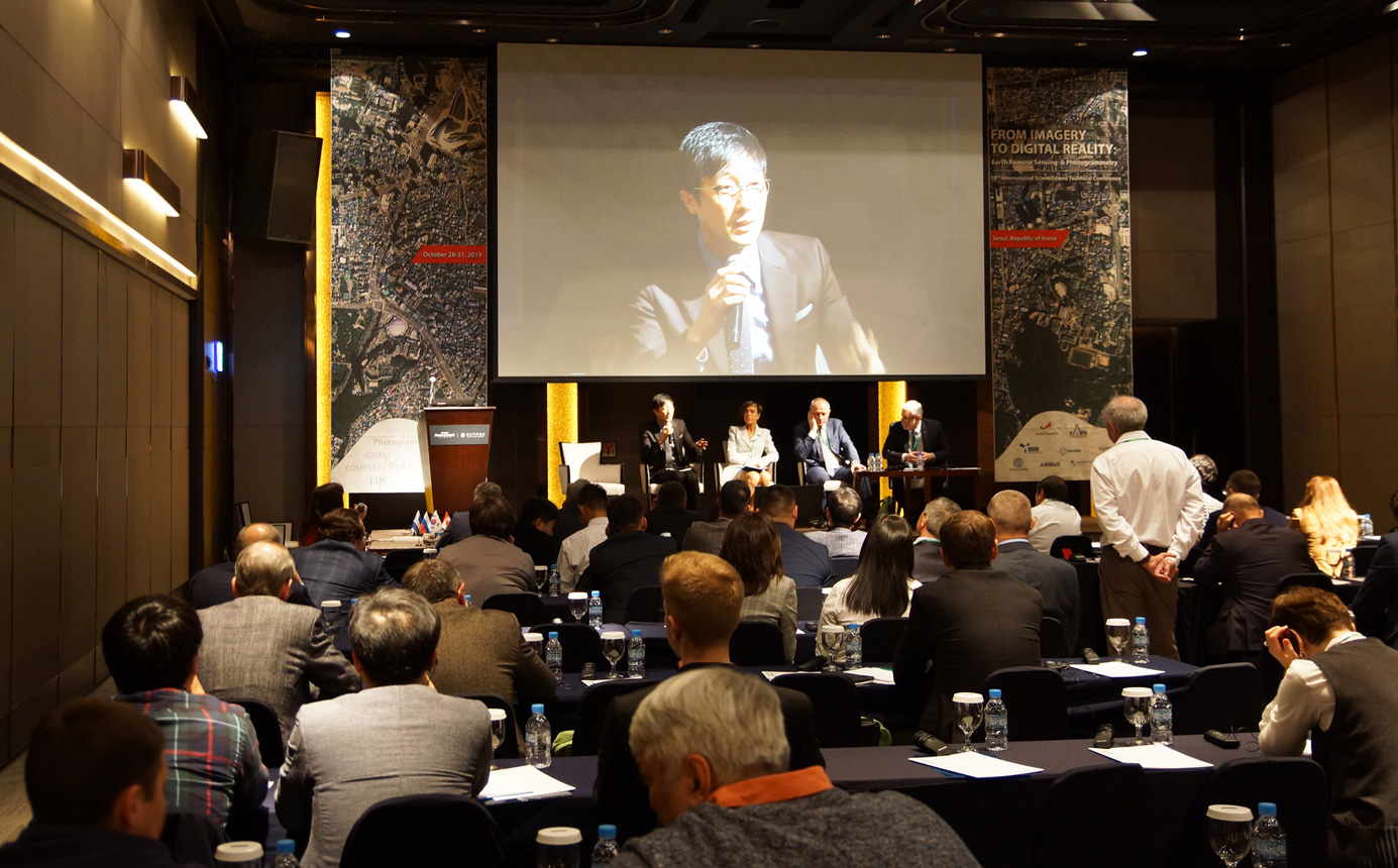
The Conference has joined more than 40 private and governmental companies from 10 countries. 32 reports were presented by specialist from Russia, Republic of Korea, China, USA, France and Thailand in 8 plenary sections.
Day One
 Victor Adrov, Racurs’ Managing Director, Russia, opened the Conference wishing participants to establish new business contacts and have fruitful work. Valeriy Zaichko, Head of Department, ROSCOSMOS, Russia, delivered welcoming speech, noting the importance of international cooperation in the field of remote sensing.
Hyo-Suk Lim, Executive Director, Korea Aerospace Research Institute, Satellite Operation & Application Center, Republic of Korea, delivered keynote address. Ms. Lim emphasized the importance of the practical use of remote sensing data, wishing participants to establish partnerships with Korean companies in order to jointly solve pressing issues.
The scientific part of the first day consisted of four sections:
“Innovative Technologies of Geospatial Data Acquisition”, “Geospatial Technologies for the Smart City”, “Aerial survey systems”, ”DPW PHOTOMOD: Users Experience and New Possibilities”.
The section “Innovative Technologies of Geospatial Data Acquisition” was devoted to the experience of the new photogrammetric and adoption of geoinformation technologies in Russian and Republic of Korea.
Konstantin Litvintcev, Adviser of the Head, The Federal Service for State Registration, Cadastre and Cartography (Rosreestr), Russia, reported about Russian cadastral system and experience of using stereophotogrammetric models. His colleague, Joo Hyun-Hee, Team leader of International Cooperation & Standardization team, National Geographic Information Institute, Republic of Korea, spoke about approaches in organization of national infrastructure of Korea’s spatial data. Elena Kravtsova, Lead Engineer Photogrammetrist, Roscartography, Russia, devoted her report to Digital Geospatial Data of JSC Roscartography.
Solutions making it possible to arrange urban management at a fundamentally different level of efficiency were considered in “Geospatial Technologies for the Smart City” section. Mikhail Petukhov, Head of Geospatial department, Hexagon Russia made report about improved productivity of 3D city mapping with a new hybrid sensor Leica CityMapper-2.
Software solutions of KB Panorama for Smart City development were presented by Alexander Kirichenko, Project Manager, KB Panorama, Russia. Anna Aliabieva, Director of Engineering Center, Ural-Siberian Geo-Information Company, Russia, reported about universal stereophotogrammetric model for urban management. Representative of South-Korean company G-ros, Joonho Cha, spoke about UAS data processing for 1/1,000 topographic map used by municipalities of Republic of Korea.
Theoretical and practical aspects of aero survey were considered during “Aerial survey systems” section. Yuri Raizman, Chief Scientist, PhaseOne Industrial, Israel, gave an overview of the new generation of PhaseOne aerial cameras and systems. Pavel Anashkin, Managing Director, Uralgeoinform, Russia, shared practical results of the survey using PhaseOne systems. Irina Anikeeva, Senior Scientist, Roscartography, Russia, reported about signal-to-noise ratio estimation of aerial and satellite images. Report devoted to calibration of long focal length cameras was presented by Aleksandr Chibunichev, Head of the Photogrammetry Department, Moscow State University of Geodesy and Cartography, Russia.
The last section of the first day was dedicated to the experience of use and new features of PHOTOMOD version 6.5. Xu Mingce, General Manager, SmartSpatio Sci-Tech Inc., China, spoke about PHOTOMOD 2D/3D processing and application in China. Jasmin Babić, Co-Managing Director, Geo-centar Asia Co., Kingdom of Thailand, shared Geo-centar's experience and improvement suggestions in working with PHOTOMOD. Victor Adrov, Managing Director, and Dmitry Kochergin, Head of the technical support department, Racurs, Russia, spoke about the new PHOTOMOD features. Andrey Sechin, Scientific Director, Racurs, Russia, introduced new technology that allows you to perform stereo measurements on a smartphone using simple virtual reality glasses.
Day Two
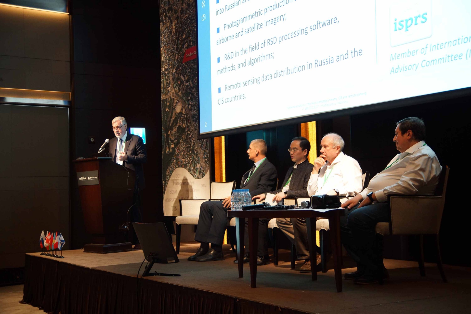
Four sections of the second day traditionally covered the issues of space imagery: “Earth Remote Sensing Satellites Systems”, “Satellite Data: Use Cases”, “Satellite Imagery and Geodata Services”, “RSD for Education”.
“Earth Remote Sensing Satellites Systems” section gathered the world's leading operators of remote sensing systems. The section was opened by Valeriy Zaichko, Head of Department, ROSCOSMOS, Russia, reporting about today and tomorrow of Russian Earth Remote Sensing system.
Wookhyun Choi, Vice President, SI Imaging Services, Republic of Korea, presented company’s activities and spoke about KOMPSAT facilities. Fabrice Rodriguez, Head of Reseller Growth, Airbus Defence and Space, France, presented OneAtlas platform. Ilia Yudin, Sales Manager Russia and CIS, Maxar Technologies, USA, reported about perspectives of MAXAR technologies for users in geospatial industry.
Four reports were presented in “Satellite Data: Use Cases” section. Sergey Potapov, Deputy Head of the research production complex, Research Institute for Precision Instruments, Russia, shared his vision about geospatial data for Industry 4.0. Alexander Chekurin, Sales & Marketing Director, Racurs, Russia, made report about PHOTOMOD Radar for processing of SAR images. Stanislav Kaniukov, Head of RSD solutions division, PRIME GROUP, Russia, spoke about the experience of interferometric monitoring in the Arctic zone. Maxim Altyntsev, Associate Professor, Siberian State University of Geosystems and Technologies, Russia, reported about forest space image decoding using the structural-statistical approach.
“Satellite Imagery and Geodata Services” joined both suppliers of large solutions and small technological startups. Valeriy Zaichko, Head of Department, ROSCOSMOS, Russia, spoke about possibilities of Russian integrated geographically distributed Information system of earth remote sensing. Victor Lavrov, Deputy Director, Geoproject, Russia, shared the experience of using geoinformation solutions of Geoproject Company. Alexander Kirichenko, Project Manager, KB Panorama, Russia, spoke about innovations in cartography. Yuri Raizman, President & CEO, GeoCloud, Israel, presented results of the first year of operation of GeoCloud SaaS platform.
The final section of the conference “RSD for Education” was remembered for its bright reports made by: Olga Gershenzon, founder, LoRReT, Russia, who presented the technology for the operative obtaining of space images to small mobile stations for educational tasks; Nikolay Vedenkin, President, Fund for the revival of professional engineering education and training of personnel reserve among children and youth Cassiopeia, Russia, fascinatingly spoke about international education program for air quality investigation based on remote sensing data and Matvey Kopylov, student, Apple Tree, Republic of Korea, who reported about the who talked about the school space club.
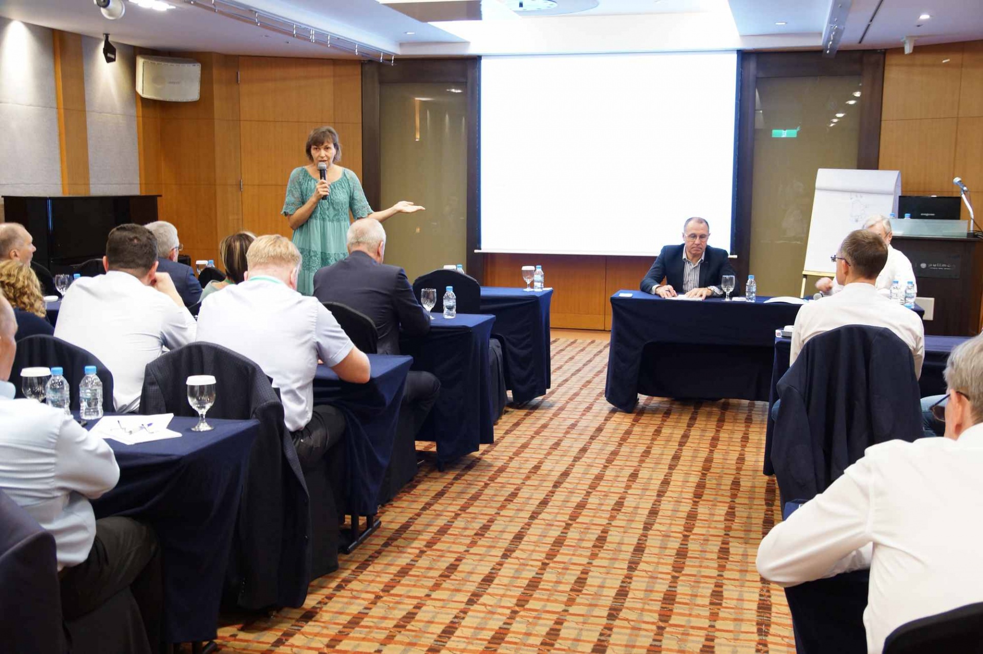
The third day of the conference included master classes on the new PHOTOMOD version 6.5 and a round table “The Role of Remote Sensing for Industry 4.0”. During the round table, world leaders in the field of remote sensing and users of space information discussed the requirements for distributed systems for receiving, storing, delivering and processing of space data.
Within the framework of the conference, at the initiative of Rosreestr, a bilateral meeting of specialists of the National Institute of Geographic Information of the Republic of Korea with the Russian delegation took place.
This year’s social program included a geodetic quest in the ancient Korean village Namsan Hanok where participants were offered to find a geodetic sign and convert coordinates using the PHOTOMOD GeoCalculator application for Android. Yerken Ospanov from TerraLink Technologies Company, Kazakhstan, became the winner of the quest. The traditional PHOTOMOD lottery took place during the banquette. This year the fortune favored Mr. Aleksandr Bobylev, Uralgeoinform Co., Russia, and Mr. and Su Heping, SmartSpatio Technologies, China.
We thank all our colleagues, friends, and partners for their participation, and we look forward to seeing you again!
![]() Conference Program |
Conference Program | ![]() Speakers |
Speakers | ![]() Conference Proceedings |
Conference Proceedings | ![]() Presentations
Presentations