 Conference Review
Every year our conference brings together the best specialists of the field from dozens of countries and provides them excellent opportunities for professional communication and discussion.
One of the features of the Conference is its annual change in location. This not only allows for a variety of Conference work, but it also opens up new opportunities. We chose China as the venue, taking into account the increased influence of Chinese on the remote sensing and geoinformation market. Currently the Chinese market is one of the most challenging consumers and suppliers of geospatial data. Due to China’s huge area, rapid economic growth, and advances in space technology, the world’s leading companies aspire to work with this nation. Our decision to hold the Conference in China is further proof of the great importance of the Chinese market to methods of remote sensing development and photogrammetry technologies.
This year the conference brought 120 specialists together, representing more than 60 companies from 13 countries. You can find more detailed information on the Statistics page.
Day One: Achievements and the Future
Participants from 10 countries—Germany, Israel, Kazakhstan, China, South Korea, the Netherlands, Russia, the United States, France, and Switzerland—presented 40 reports in the scientific part of the conference.
Victor Adrov, Racurs’ Managing Director, opened the conference. Then Xu Mingce, Managing Director of SmartSpatio Company and co-organizer of the conference from the China side, took the floor. Participants were also welcomed by Chen Jun, President of ISPRS; Fen Syangun, Director of SASMAC; Valery Zaichko, Head of Department at Russian Federal Space Agency; and Yuri Gagarin, Deputy Head of the Federal Forestry Agency.
The first day of the conference was devoted to the most important topics affecting both the current state of technology and its future:
- • Spatial data infrastructure
- • Modern 3D modeling
- • Aerial survey equipment and UAS
- • Photogrammetric processing of aerial images—methods and algorithms
 The scientific program began with two reports dedicated to the spatial data infrastructure. Professor Gottfried Konecny from Leibniz University Hannover (Germany) shared about the current state of global geospatial information. Professor Chen Jun from the National Geomatics Center of China reported about 30-m global land cover mapping classification approach and data products.
Some practical examples were presented during the second set of reports devoted to modern 3D modeling. In particular, Professor Armin Gruen (ETH, Switzerland) and Professor Alexander Mikhailov (MIIGAiK, Russia) told about 3D modeling of the Shukhov Tower. Professor Mathias Lemmens, representative of the Netherlands (Delft University of Technology) reported about features of point clouds and functionalities of processing software. Then Alexander Chekurin (Racurs, Russia) shared about the technology of 3D GIS creation for urban areas based on remote sensing data. The third set of reports was dedicated to the modern aerial survey equipment and UAS. Of particular note was the report presented by Yao Jifeng (Beijing Geo-VisionTech, China) devoted to the still little-known cameras of the SWDC system. SWDC modules allow one to create and camera for UAV and camera with five objectives for incline survey from the aircraft.
The scientific part of the first day of the conference concluded with presentations dedicated to photogrammetric processing of aerial images. Reports were submitted by Dmitry Kochergin, Andrey Sechin, and Alexey Elizarov (employees of Racurs). Participants learned about the new version of PHOTOMOD 6.0 and dense DSM module. Questions about the system’s future were also discussed during these presentations.
Vladimir Arkhipiov, representative of FSUE “Roslesinforg,” shared information about perspective technology of forest stereomeasuring using the PHOTOMOD StereoMeasure module and program complex ESAUL.
The first evening of the conference was marked by a party, allowing guests to be distracted a bit from scientific questions. Participants enjoyed the playing of a charming, ancient Chinese zither and watched a great performance by Kung Fu students. Some general questions were discussed in an informal atmosphere. Two versions of the PHOTOMOD system were raffled in a traditional lottery. This year, fortune favored SCANEX (Russia) and SmartSpatio (China).
 Day Two: Space Theme
According to conference tradition, the second day was dedicated to Earth remote sensing. Reports on the following topics were presented:
- • Sattelite remote sensing systems
- • Remote sensing data—algorithms and software
- • Modern radar satellites and radar data processing
We would like to note that the leading suppliers of remote sensing data participated in the conference this year. Russia was represented by managers and leading experts from the Federal Space Agency, JSC Space Rocket Centre Progress, OJSC "RIPI,” Research Center for Earth Operative Monitoring, and JSC Russian Space Systems. The following companies represented China: Satellite Surveying and Mapping Application Center of China, China Centre for Resources Satellite Data and Application, Institute of Remote Sensing and Digital Earth, the Chinese Academy of Sciences, and China AeroSpace Science and Industry Corporation.
It was a great pleasure to see the “novices” at the remote sensing market—the Republic of Kazakhstan—and also the leading commercial data suppliers from the United States, France, and South Korea. Delegates from the Agency of Cartography and Forestry from other countries also participated in the conference.
 The second day began with the review of national space software programs; their current state and development perspectives were analyzed. Valery Zaichko (Russian Federal Space Agency), Zhou Zikuan (China Centre for Resources Satellite Data and Application), and Chang Xiaotao (Satellite Surveying and Mapping Application Center of China) presented their reports.
Kazakhstan was represented by Alan Kazkenov (National Company “Kazakhstan Gharysh Sapary”) and South Korea was represented by Wookhyun Choi (SI Imaging Services). Ilya Yudin (Digital Globe, USA) and Michael Tonon (Airbus D&S, France) presented reports on commercial remote sensing programs.
Practical aspects of processing and using findings were considered during the second set of reports. Here we should note the joint report from Racurs on “Technology 2000—SPOT 6/7 Images—Accuracy and Interpretability Properties,” an interesting presentation made by Viacheslav Lobzenev (Innovative Centre, Russia), and a report presented by Ilya Farutin and Anton Sonyushkin (SCANEX, Russia) dedicated to algorithms and software for remote sensing processing.
Sergey Potapov (OJSC "RIPI,” Russia) developed questions about industrial production of geospatial information in his report. The scientific part of the second day of the conference concluded with reports presented by Vladimir Stasevich (NPP “ROBIS,” Russia) and Igor Elizavetin (Racurs, Russia) devoted to radar satellites and radar data processing.
Chinese Lessons
 It has become a good tradition to offer interesting, informal events in addition to the scientific and business programs. This year’s presentations were dedicated to Chinese culture. Participants had a good chance to get acquainted with Chinese cuisine, dances, flower arranging, and a well-known tea ceremony.
Under a chef’s guidance, participants cooked Chinese pelmeni, which were than eaten at dinner. Dance lovers learned a traditional Chinese dance involving bamboo sticks. Discerning judges of beauty had an opportunity to create amazing bouquets and orchid necklaces. Fans of Eastern culture enjoyed the niceties of a tea ceremony.
Day Three
The third day of the conference was oriented around practice, discussions, and results. Some master classes were held, where participants met at round tables and communicated during the business meetings.
Master Classes
Specialists from Racurs offered master classes and demonstrated features of the new PHOTOMOD 6.0 version. The new algorithm of dense DSM creation, significant acceleration in UAS data proceeding through the use of distributed processing, new functions of the 3D modeling module, and multiple increase of proceeding information value in accordance with the changeover to a 64-bit system attracted the audience’s attention.
Master classes held by specialists from SCANEX were devoted to photogrammetric and thematic imageries proceeding with the use of ScanEx Image Processor software.

Round Tables
The tradition of round table discussions was successfully continued at this year’s conference, again confirming their importance to the professional community.
The “UAS Technologies” round table gathered a considerable number of participants—representatives of development companies and universities. The main question was specific to UAS using cartography for task solving. The main conclusion of this discussion was the need for deeper research on UAS survey features to achieve guaranteed results. Following the discussion results, the task of scientific research works involving different development companies on the base of test grounds was set.
The “World Cartography Trends” round table also generated very interesting and lively discussions. Many pertinent questions facing the community in this field were identified:
- • What data format will be the most relevant in the near future?
- • Who must determine this format—the consumer, the provider of geospatial data, or the government on behalf of its specialized agency?
- • How and to whom it is important to present 3D and 4D spatial data?
Quoting the famous Steven Spielberg, Professor Armin Gruen noted that modern cartography must be as three-dimensional as our world. Participants at the round table agreed on the consumer need and technological possibility of 3D representation of spatial data, but they marked a significant backlog of the current normative base.
The “Photogrammetric Technologies in Forest Management” round table gathered specialists from the State Forestry Administration of P.R. China, the Russian Federal Forestry Agency, the Ministry of Environment and Green Development of Mongolia, and suppliers of aerial cameras and remote sensing data.
Vladimir Arkhipov (FSUE “Roslesinforg,” Russia) shared the results of the practical use of forest stereo evaluation based on data from the A3 camera (VisionMap) and PHOTOMOD StereoMeasure. Representatives of FSUE reported on the results of stereo surveys from space vehicles and the success of China’s governmental policy on protecting and restoring forest resources. The result of their efforts was the growth of forest area in China.
Ilya Yudin (DigitalGlobe, USA), one of the largest suppliers of remote sensing data, noted the considerably increased role of satellite imagery for the purpose of forest resources control. First of all it is concerned with the substantial improvement in accuracy characteristics and resolution of the new satellites. Participants agreed that forest resource control is a difficult, multidimensional task, so to determine the optimal technology solutions it is necessary to consider all the possibilities offered by modern means of remote sensing.
Business Meetings The conference usually offers a great opportunity for participants to establish business relationships. The team of professional interpreters made communication between participants easy. Russian and foreign companies have signed a number of memoranda of partnership and business cooperation. Agreements on the mutual exchange of remote sensing data for testing were signed between Russia, China, and Kazakhstan. It is safe to say that the conference helped many participating countries develop cooperation within government agencies and between commercial organizations.
The Conclusion of the Conference
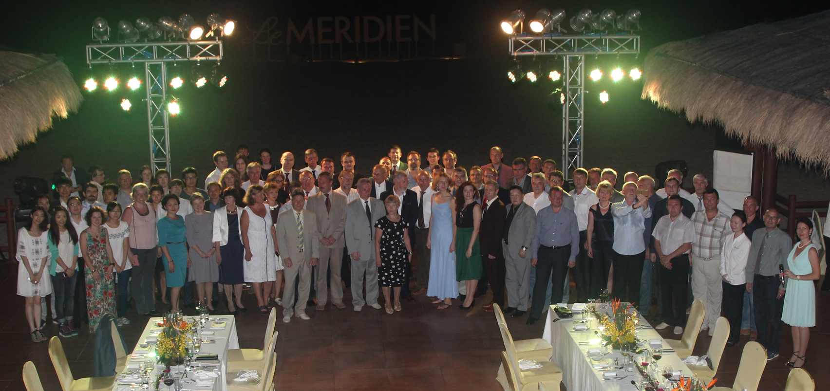
A gala dinner was a bright finale to the conference. It was held on the beautiful, tropical beach. Let us note that the partners of the conference were pleasantly surprised by handmade gifts produced by Racurs employees.
According to established tradition, Roscosmos presented medals to those making outstanding contributions to the field of remote sensing. This year the Yuri Gagarin medal was awarded to Professor Armin Gruen (ETH, Zurich) and Michael Tonon (Airbus D&S expert).
The gala dinner atmosphere was warm, with plenty of toasts and encouragements to the organizers to choose the venue of the fifteenth conference soon.
We thank all our colleagues, friends, and partners for participating in the conference, and we look forward to seeing you again!